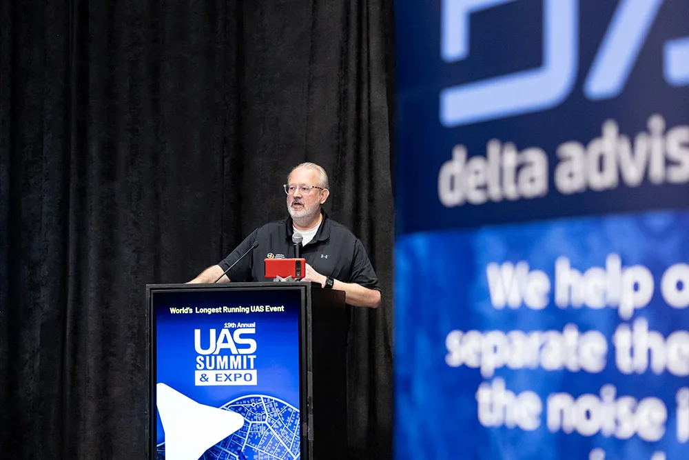
Vigilant Aerospace Systems CEO Kraettli L. Epperson presented at the 2025 UAS Summit & Expo this year on airspace management, including how ‘detect-and-avoid’ (DAA) capabilities are becoming foundational for routine uncrewed and autonomous flight.
The presentation outlined the regulatory and operational drivers behind this shift, including sustained growth in ‘Unmanned Aerial System’ (UAS) and ‘Advanced Air Mobility’ (AAM) operations, the Federal Aviation Administration’s (FAA) emphasis on integrated airspace, and the agency’s clear expectation that future operations under the newly proposed Part 108 and Part 146 rules will rely on highly automated safety systems rather than human-in-the-loop mitigation.
Epperson detailed how Vigilant Aerospace’s FlightHorizon software provides standards-compliant, multi-sensor DAA and airspace visualization by fusing radar, Automatic Dependent Surveillance–Broadcast (ADS-B), Remote ID, and autopilot data. FlightHorizon uses these to generate real-time traffic awareness and automated avoidance guidance for both ground-based and onboard use.
The presentation also focused heavily on real-world deployments that demonstrate how these systems are already being used in operational environments. Examples included large-scale radar-based airspace surveillance at the Oklahoma Air & Spaceport at Burns Flat, an urban-adjacent deployment at Skyway Range in Tulsa, and an integrated system at the University of North Dakota’s Gorman Field supporting mixed civilian and military flight activity, education, and research.
Additional case studies presented in the talk covered onboard DAA testing for U.S. Air Force Research Laboratory (AFRL) programs and portable systems used for federal research missions, illustrating how system architecture and sensor configurations vary based on aircraft class, mission profile, and operating environment.
The October 14th talk concluded that shared airspace infrastructure, combined with advancing sensors, edge computing, and automation, are emerging as a practical and scalable model for enabling safe, autonomous UAS operations across both civilian and defense applications.
The UAS Summit & Expo is an annual event that brings together government, military, and industry leaders to discuss how uncrewed aircraft and autonomous aviation are being used today, the challenges they face, and where the technology is headed.
Watch the full presentation below for more information:
Presentation
Full Transcript
Hello, I’m Kraettli Epperson- the CEO and co-founder of Vigilant Aerospace- I’m going to take you through my presentation today.
We’ll start with an overview of aerospace management and DAA and why it is so urgently needed right now.
I’m going to talk a little bit about our company and our products to give you a little bit of background.
I’ll also talk about the technology that is used, a little bit about the components and systems that we utilize, and the essential components that go into these systems and make detect and avoid possible.
I’m going to focus mostly on real-world implementations that we have running now, including one here in Grand Forks, and then I’ll end up with a little bit of information about how to get involved if you’re interested in this topic or in working on these things.
For a little bit of background here, why is airspace management and detect and avoid so critically important right now?
Right now, we have rapid growth, year over year growth of at least 15% for drones generally in the United States.
That’s cumulative year over year- and then advanced air mobility for larger UAS just on the civilian side is growing 25% per year compounding- and those statistics are going to lead to a real need for these DAA systems.
DAA and airspace management systems provide, in our case, both detect and avoid, and visualization and mapping of where uncrewed aircraft are located in relation to crewed aircraft.
So the FAA has really prioritized integrated airspace, not having segregated airspace for UAS, and automatic separation is a really high priority.
This is really embodied in the new notice of public rulemaking around Part 108 and Part 146 particularly, the FAA has indicated that they strongly expect that the aircraft flying under these new rules will be highly automated and that the mitigations and collision avoidance and detect and avoid systems will be highly automated and will not rely on human intervention.
That’s really putting pressure on industry and companies like us to deliver this technology to the end user in the front line as soon as possible.
One of the things that the FAA has proposed in the new Part 146 rules would be the idea of an automated data service provider.
This is a service that would be available to all types of UAS and AAM operators that would provide airspace surveillance.
This also composes a business model and then the use of uncrewed traffic management, UTM, where the concept has been around for a while, but it’s now going to be embedded in the rules that it’s an important way to do strategic deconfliction in planning and use of multiple UAS in a single airspace.
This really creates a need for infrastructure.
The idea is that communities can compete economically by having that infrastructure prepared.
And that is a lot of what we do with our projects is to help communities prepare for this future of UAS and autonomous aircraft.
Really, our watchword is that there’s really no autonomy without autonomous safety.
It’s really critical, and we keep that in mind in all of our work and all of our projects.
We’re Vigilant Aerospace Systems.
We provide the Flight Horizon product suite.
We provide primarily detect and avoid. This is standards compliant detect and avoid.
It can be used to get FAA waivers, for example, or very soon we’ll be able to be used under the new Beyond Visual Line of Sight rules.
It’s based on a couple of NASA patents that we licensed.
I had the privilege of serving on the FAA’s Beyond Visual Line of Sight Aviation Rulemaking Committee.
And so we’ve been developing this product for this purpose for some time.
It’s really designed to track aircraft and enable both the operator or an onboard system, because we also have onboard versions, to provide its own deconfliction from other aircraft.
We also have versions that can be used with radar and versions that can be used without radar if you’re in a space where the aircraft all have transponders, for example.
This is a really brief overview.
This is a screenshot of our technology.
It is often used onboard without a user interface, but if you do have a user interface, you can see what the software is doing.
You have your own aircraft, the small white aircraft to the right there, that is being tracked, and then you have intruding aircraft, and the software will calculate if there’s a need for a resolution advisory to get your aircraft out of the way of that aircraft that’s coming towards you.
We use standards from both RTCA and ASTM to be sure that the algorithms that we’re using and the hardware and software combination that we’re using will allow you to meet those standards.
We focus on the software.
We work with partners, several of whom are here and have booths here today to provide the radars, ADS-B receivers, and other items.
This is a very brief video of how this works.
Just a few seconds of video here.
You can see the aircraft with the well clear, that yellow colored hockey puck shape.
That is the UAS.
It is running our software here.
The software has detected that there’s a potential conflict between those aircraft, and so it’s provided that resolution advisory.
It says speed up, turn left, and so the system will do that.
it will take that maneuver and then avoid that encounter and maintain that safe distance from that other aircraft.
So really, really quick demonstration of this system, the actual software working.
For our ground-based detect and avoid system, airspace management, our FlightHorizon Tempo system, these are the typical components.
I’ll go over these very quickly.
So our software runs in the middle.
It pulls in information from the autopilot, pulls in information from usually a ground-based radar, and then pulls in information from transponder receivers.
And if available, we’ll also pull in information from the remote ID receiver to see other drones.
It then turns that either into a display or an airspace map that it uses to determine those loss of well clear calculations that I showed in the prior slides.
And so those are critical components that are involved in each of the systems that we deploy.
Very briefly, we have several varieties of this software.
We have Tempo, which is the ground-based, cloud-based system that we are rolling out.
I’ll talk about that with several projects here.
We have Pilot, which is the onboard version.
We’ve recently done a project for the Air Force to customize that for long endurance drone, and we have a variety of other UAS that that is being customized for right now.
We have a ground-based drone detection version, and then we have an ultra-low-cost flight horizon alert system that is used without a radar, used with transponder receivers to provide in a single box a way to track and deconflict aircraft, particularly around small airports.
All right, so now I’m going to talk about some of our real-world deployments, and I’ll talk briefly about each of these as we go through them.
One of our first deployments of our ground-based system was actually with the 49th Operations Group at Holloman Air Force Base in New Mexico.
They have training flights with the MQ-9 Reaper.
This system was actually initially developed by NASA and the patents were around the use of the system, particularly with the ICANA, which is the civilian Reaper that NASA Armstrong runs.
This was installed behind the firewall at Holloman Air Force Base so they could track all of their training flights, and we included both their data, military data on traffic and civilian data on traffic, all fused together into this view so that it could be used for those training flights.
And so that was a great project for us, allowed us to integrate a lot of data in a very secure environment and demonstrate how this would work for large-scale military operations.
We also have a system now in western Oklahoma at the Air and Space Port.
This is colloquially called Burns Flat.
This is a system which has seven radars, six large radars, one small 3D radar, and it’s being used to build out a major test site in western Oklahoma.
Here’s some pictures of those radars.
About half of those have already gone in, and the other half are being delivered before the end of the year.
They’re all being set up, integrated, tested, and calibrated right now.
We’re literally working in Florida right now with the manufacturer D-TEC, who is working on delivering the second round of radars.
These are the radars that have already been delivered and are in place and on-site in Oklahoma.
Here’s a map of some potential locations.
There’s going to be six of these large radars.
They cover a very large area and provide air traffic surveillance.
And I’ll talk a little bit about why we’re doing that.
These are not the exact locations of where those radars will go.
That’s still being determined and depends a lot on land use.
But ultimately, this is the type of coverage that these large radars will provide.
So this meets their goal of having a wide area, real-time air traffic surveillance system for UAS testing, supporting large UAS flights and testing, at a relatively affordable price.
This system has been very economically designed and developed, and it provides automatic traffic warnings and automatic deconfliction, as all of our systems do, across all of our installations.
This is a network system, so it is sending data up to remote servers.
We have primary and backup servers.
It’s about 16,000 square kilometers in phases one and two this year for this air traffic surveillance system.
It’s one of the largest areas like this in the United States.
Integration to the UAS itself, the drone, is provided at the ground and then we have ADS-B receivers and we can pull in lots of other data and we can expand this system as we add additional units.
They have the capability using our system and our software to go ahead and add additional units- these units are on trailers, so they’re portable.
That way, if they have a flood or another type of incident that they need to respond to, they can move these systems out to provide safety for drones that are responding to those incidents.
Really important state priority and a community priority for being able to operate these systems.
We have another similar system at Skyway Range in Tulsa.
It’s an interesting system because it is at an urban-suburban boundary area.
Great for beginning to prototype delivery and use of other types of drones for construction, agricultural surveying, all kinds of purposes.
We have one radar there and Skyway Range has another radar.
We use both of those radars and they have a testing center there that they can fly drones in that urban environment.
This is a picture of the system actually working.
This is kind of what our user interface looks like when you attach multiple radars to the system and multiple receivers.
You can see there that you’ve got actual aircraft flying through that space.
They were focused on multi-sensor air traffic surveillance and management for their urban drone port.
And they want to be able to support small UAS and then larger UAS flights in and around this kind of urban-suburban boundary.
They want to be able to test development of drones and then move towards some of these commercial missions.
That system is also fully networked.
It’s using servers in the cloud to pull all that data in, provide tracking, logging, and be able to provide automatic conflict deconfliction for those drones from other aircraft that might be nearby.
Those radars are also portable and can be moved on a trailer.
We have another system, I know you all here in Grand Forks will be excited to hear about that, at UND’s Gorman Field.
This is using a couple of their Detect radars, a couple of Mark 5s, out at Gorman Field.
I’ll show you some pictures of what this system looks like.
So this is the software running with a connection to one of those radars pulling in data from air traffic.
This is a little different system.
They have their own server and we’re still rolling out some of the software and systems to that server.
We’re excited to see that used through the end of the year.
Some more pictures of that system tracking aircraft over Gorman Field.
They’re very interested in providing real-time airspace tracking, but also being able to use it in a mixed environment.
They have a lot of different types of aircraft, military aircraft, military UAS.
All of this had to be done locally because they want to keep the data on site for security purposes.
And they also have really important educational goals.
All those things were considerations as we were designing and rolling this system out.
We’re still in radar connection mode and calibration mode for that system, but we’ll be excited to see it through the end of the year come into use with some of the major projects that they’ve already talked about on stage today.
I’m going to talk briefly about our onboard system. It’s called Flight Horizon PILOT, and so I’ll give you a little bit of outline of that.
It’s Very different than the ground-based system that uses the same underlying technology.
Now I’ll talk a little bit about the components.
This will be a single board, small computer that actually runs the software on the aircraft.
We’ll pull in information directly from the autopilot and from one or two very small radars.
These are Echodyne radars.
They also have a booth here today, and you can go look at their radars that are designed for flying on board group three, four, five, sometimes group two style aircraft.
They use information from ADS-B receivers and transponders.
Then, that is either sent to the Flight Horizon user interface, or the commands are sent directly back to the autopilot.
Sometimes both.
We’ve also designed plug-ins for other ground control stations, including military ground control stations, so that information can be provided directly to the remote pilot in whatever ground control station they’re using.
This is just a photo of some of these actual components that have been used in some of our projects.
You can see these radars.
They’re about 1.8 pounds each.
They’re very small, a small single-board computer, and then direct integration to an autopilot.
So it’s a very compact system, very modular.
We can add or subtract radars as needed.
We can also add additional data sources and sensors.
And it will usually piggyback on the command and control radio that’s already installed on that system.
These are some photos from some of our recent testing for an AFRL, Air Force Research Lab project, in which we were using multiple radars and beginning to build out this model of this dual-use product.
So it’s used for both military and civilian use.
This is a picture of some of the simulation and modeling work we’ve done with this system on using multiple radars onboard and how it’s able to track and provide real-time immediate warnings on a loss that will clear for aircraft that might encounter that large UAS.
The goals here, obviously, were to provide on-board, real-time detect and avoid, and to fly safely in integrated airspace.
This is also important because they want to integrate in civilian airspace, as do all of our users of this onboard system, to have standards compliance and to receive regulatory approvals.
This current system is in a prototype phase- It is on multiple UAS.
We have multiple radars that we’ve integrated with it, multiple ADS-B receivers.
We do have autopilot integration for a couple of different autopilots, and those algorithms are tuned for that particular aircraft and the performance of the aircraft on which it ends up.
There’s work to do on some of the radar tuning, depending on what aircraft it goes on to.
We have to do some of that testing in order to actually have it in the field.
But we are very excited about this system.
This is really the direction that the industry is going, where you can carry your own DAA system with you everywhere you go on a large to mid-sized UAS, highly flexible system, can integrate with a wide variety of autopilots.
This is another project we did using that same style of radar with a portable system.
This was ground-based, but it was the same software testing our radar integration and the ability to do DAA.
This was for NOAA, and this is tracking drones actually.
So we tuned the radar a little bit differently in order to be able to track drones instead of larger aircraft.
And this was just a quick demonstration we were doing with NOAA at a weather research project in which they wanted us to be able to track their drones as they were setting them up and using them for weather data collection.
Real-time air traffic and detect and avoid, very important.
A Mix of aircraft and operating models are supported in this kind of environment.
It’s highly portable, it runs on a laptop in this case, or on a small single board computer, and it can be serviced by a single person with a backpack and can be deployed very quickly in under an hour.
That’s what we did for this project particularly, just to prove that it can be done, be up and running, be tracking those drones immediately.
Highly expandable, we can add multiple radars to this system.
So concluding, just a few things to talk about here.
This technology exists today to enable safe, integrated airspace and safe integration of UAS into the national airspace.
And it’s really going to be necessary under the new rules and regulations.
And as both the UAS and the AAM industry grow rapidly, these types of systems are critical for having fully autonomous aircraft.
They also provide a competitive advantage for communities, facilities, and programs to go ahead and have this infrastructure prepared and in place.
A lot of the projects that we’re doing are to help facilities and communities get ready for this future of aviation.
Part 108 and Part 146, those proposed rules, which are really only for certain categories of the UAS at lower altitudes and lower risk, but point the way towards a future in which highly autonomous deconfliction and highly autonomous operations will prevail.
And so these systems are going to have to be in place for those rules to really be effective.
And the new business models of the automated data service provider are going to be a critical part of enabling that as these rules develop and get finally published in some form.
Sensors and computing power are continuing to advance.
They’re really more affordable, more capable, miniaturized, and integrated, and this allows a much higher degree of safe autonomy- we’re really excited about that.
We work closely with our hardware partners to have access to the very latest of these sensors and computers to allow our system to be put on even smaller aircraft and to be even more portable and easily deployed and more affordably deployed.
And then finally, using the shared infrastructure model where UAS operators do not need to bring their own systems, but the community, the drone port, the airport, other stakeholders can set up this infrastructure ahead of time or in cooperation with operators is really the way forward, the same way that we have airports and we have shared infrastructure that’s paid for by every ticket holder.
We believe that the future of UAS is very much going to be around this shared infrastructure, and the FAA is really moving forward with that rapidly with the new NPRM and then other things that they’re doing around AAM- so we know that this is going to be the path forward.
If you’d like to talk to us further, here’s our contact information.
I can also provide some business cards.
We’d be happy to talk to you.
We are looking for organizations with aircraft, test aircraft, facilities, locations at which they would like to see a system like this deployed.
And we also have opportunities, particularly in Western Oklahoma, if you have an aircraft that might be suitable to fly under a system like this.
They are very interested in having you operate there.
And of course, we know Gorman Field also is a great candidate to have your system used with this type of aerospace management and tracking.
And we’d be happy to talk with you about either of those.
Thank you all very much.
About UAS Summit & Expo
The UAS Summit & Expo is an annual conference focused on uncrewed aircraft systems (UAS), advanced air mobility, and autonomous technologies. It brings together government, military, and commercial stakeholders to address operational, regulatory, and technology challenges. The event features technical briefings, policy discussions, and an exhibition highlighting current and emerging UAS capabilities.