Vigilant Aerospace Systems’ FlightHorizon airspace management software has been used by the National Aeronautics and Space Administration (NASA) to track and log flight activity for multiple research efforts, including the agency’s Commercial Supersonic Technology (CST) Project and the ND-MAX Multidisciplinary Airborne Experiment (ND-MAX) within the NASA Airborne Science Program.
In these programs, FlightHorizonX supported real-time tracking, geofenced situational awareness for defined test areas, and post-flight data logging for analysis. These capabilities are aligned with flight test needs where precise airspace monitoring, coordination, and traceable records are required to support research objectives and operational safety.
FlightHorizonX and Supersonic Tracking Standards Development

Vigilant Aerospace developed FlightHorizonX in 2018 to support NASA’s work on supersonic aircraft technologies and associated operating concepts, including enhanced tracking approaches for higher-speed flight regimes. The effort was tied to NASA’s supersonic research activities, including work at NASA Armstrong Flight Research Center, where the agency conducts flight research and supports development and evaluation of new flight technologies.
NASA’s CST Project focuses on developing tools, technologies, and knowledge intended to reduce key barriers to practical commercial supersonic flight. These barriers include sonic boom impacts and the integration of supersonic aircraft operations into the National Airspace System.
Quiet Supersonic Flights 2018 Over Galveston

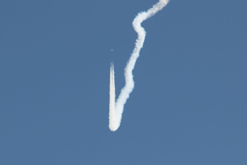
In November 2018, NASA conducted Quiet Supersonic Flights 2018 (QSF18) over the Gulf of Mexico near Galveston, Texas. QSF18 was designed to advance methods for lower-impact supersonic operations and to support data collection tied to community response and operational procedures. NASA facilities at Ellington Field supported aircraft operations for the campaign.
During QSF18 operations, FlightHorizonX was used to support supersonic flight tracking as part of the test activity. NASA’s team monitored flight operations from Ellington Field using FlightHorizonX to maintain real-time awareness of the test aircraft and other traffic in the area, while applying a geofenced view of the designated operating region.
The system also generated airspace logs to support post-flight review and analysis, which is a common requirement in flight research campaigns that depend on repeatable test points and traceable operating conditions.
Pilot-Facing Situational Awareness During Test Maneuvers

In addition to ground-based monitoring, FlightHorizonX was configured to provide airspace awareness directly to the NASA pilot conducting the supersonic maneuvers. In this use case, the system was displayed on a tablet mounted to a kneeboard, enabling the pilot to maintain awareness of the operating area and nearby traffic while executing the planned flight profiles.
This pilot-facing configuration reflects a broader trend in flight test operations. Programs increasingly rely on compact, cockpit-adjacent digital displays for test area awareness, particularly when aircraft are operating within structured test blocks and under defined separation and coordination procedures.
ND-MAX Formation Monitoring in German Airspace
Earlier in 2018, FlightHorizon was also used during ND-MAX, a joint NASA and German Aerospace Center (DLR) flight experiment conducted in German airspace. ND-MAX included coordinated flight operations involving NASA’s DC-8 flying laboratory and DLR’s Advanced Technology Research Aircraft (ATRA), an Airbus A320 used as a research platform.
During these flights, researchers onboard the NASA DC-8 used FlightHorizon to monitor and maintain a tight formation behind the A320 in order to sample and evaluate high-altitude fuel emissions. ND-MAX research has been described by NASA as part of a partnership mission intended to study aircraft emissions and related atmospheric effects, including contrail formation and associated measurements.
Why This Matters for Flight Test Operations
Across both supersonic and atmospheric science applications, these use cases highlight several operational requirements that continue to shape research flight infrastructure:
- Geofenced test-area visualization to support defined operating volumes and flight corridors.
- Real-time traffic awareness to maintain separation and coordination in shared airspace.
- Structured data logging to enable repeatable testing and defensible post-flight analysis.
For research organizations and test ranges, these requirements typically apply regardless of aircraft type. They extend from high-speed flight research to formation sampling, sensor validation, and other missions where controlled operations and traceable records are central to the test plan.
Video
About NASA’s Airborne Science Program
NASA’s Airborne Science Program (ASP), within NASA’s Earth Science Division, provides aircraft platforms and operational support for suborbital science missions that collect high-resolution measurements of Earth’s atmosphere, oceans, land surface, and cryosphere. The program supports field campaigns, satellite calibration and validation activities, and the development and testing of new sensors and data systems for future Earth observing missions.